
Alta-Collins ended up with 1.74" of water equivalent and 19" of snow. Outside of the Cottonwood Canyons, generally 6-12" of new snow is being reported. We have a break now until tomorrow, when the next, potentially bigger, storm arrives.

 Open web. Clear feed.

Utah Forecaster @OpenSnow
Alta-Collins ended up with 1.74" of water equivalent and 19" of snow. Outside of the Cottonwood Canyons, generally 6-12" of new snow is being reported. We have a break now until tomorrow, when the next, potentially bigger, storm arrives.
HOLY SMOKES! Alta-Collins picked up 0.40" of water equivalent between 7-8pm. Up to 1.30" water total now. Officially over the PEAKS forecast I posted this morning.

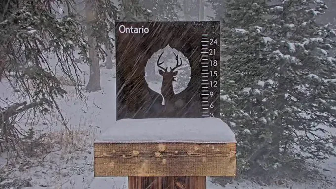
I’m really happy Snowbasin is getting snow, but why do they always put the board so close to the ground/surface of the snow?!? Anytime we get any decent amount of snow it gets swallowed up and becomes useless.

The second wave is here. Snowing hard again!

Alta-Collins was showing 6" of snow from 0.81" of water equivalent at 3 pm. We are in the lull between the two waves. The colder wave picks up this evening.
Alta-Collins was showing 6" of snow from 0.81" of water equivalent at 3 pm. We are in the lull between the two waves. The colder wave picks up this evening.
Brian Head with 7" already today! Things are escalating quickly in Northern Utah, too. Giddy up!



Snowbird's 15.7 inches of water since the start of the water year (Oct 1) is the most ever on this date! Yet, we are only at 67% snowpack. Not to beat a wet and warm horse, but that's a crazy statistic.


It's 10:30am, and the snow is just starting to get going in the Wasatch. I'm just sitting here refreshing the webcam map views until it starts piling. Maybe "a watched snow stake never stacks?"


😍
Tall twin waterspouts over San Francisco Bay near Brisbane, CA lasting several minutes. Never stop chasing. #cawx


No change in recent runs. In fact, the darker the line, the more recent the run. The latest run has the highest QPF of any of the previous 6 runs.

Our first storm was not particularly big by our standards, but early-season snowpack numbers can jump dramatically even in small storms. Statewide numbers popped 31% in two days. These should go well above 100% over the next week.


Perhaps more snow than I thought along the crest of the Wasatch...
@WasatchSnow 10" up in the Catherine's/Pt Supreme area
I cannot describe how painful it was to forecast last winter, or how cathartic it is to write a good-news forecast like the one I posted today. Getting a solid storm cycle like this in November will go a long way toward setting us up for December and beyond.

Obviously, we have lower confidence in storms that are farther out, but I'm going to post the forecasts for Alta-Collins from this morning here. We can revisit both the accumulated water equivalent and snow next weekend to see where we came out. Let's see how PEAKS performs


