Private satellite imaging companies are restricting access to imagery over Iran, making it difficult to verify destruction caused by U.S./Israeli strikes. I developed a method to detect building damage in open source radar imagery, now peer reviewed:
sciencedirect.com/science/ar…
🛰️GEOINT: Mapping the Satellite Data Blackouts
For a while now, we've tracked a deliberate day-delay of Sentinel-2 data over the Red Sea, the Gulf of Aden, and the Northwestern Arabian Sea (specifically from Socotra Island up to Duqm). Expanding the map reveals how dynamic these boundaries are becoming.
🌍The New Gap: Massive, unnatural acquisition gaps have now appeared directly over the Eastern Mediterranean.
🌍The Persian Gulf: Fully illuminated and fine. This makes strategic sense—major coalition surface combatants have likely vacated this confined water space entirely.
🌍The Anomaly: The Gulf of Oman also remains unrestricted. This is highly curious, as any incoming amphibious force would likely need to transit or stage in those waters.
When you stack these targeted medium-res Sentinel-2 gaps on top of recent commercial high-res imagery pauses (Planet/Vantor), the information environment is clearly being locked down.
This localized "fencing" begs a massive question for the OSINT community: Are we looking at dynamic boundaries designed specifically to mask incoming naval assets? If so, when will the Gulf of Oman go dark?
This access change includes Gaza and Lebanon, not just Iran and Gulf states with US bases. Planet has been absolutely amazing, and their imagery has led to dozens of stories/scoops, with Gaza/Lebanon in particular.
Putting out a wish to the universe.
I need more compute, if I can get more I will make sure every machine from a small phone to a bootstrapped RTX 3090 node can run frontier intelligence fast with minimal intelligence loss.
I have hit page 2 of huggingface, released 3 model family compressions and got GLM-4.7 on a MacBook huggingface.co/0xsero
My beast just isn’t enough and I already spent 2k usd on renting GPUs on top of credits provided by Prime intellect and Hotaisle.
———
If you believe in what I do help me get this to Nvidia, maybe they will bless me with the pewter to keep making local AI more accessible 🙏
The results above can be replicated in the notebook below. To conduct damage assessment in a new area, just change the bounding box coordinates.
colab.research.google.com/dr…
It's not perfect but it works; in the paper, accuracy is assessed using >2 million labeled building footprints across 30 cities across Palestine, Ukraine, Sudan, Syria, and Iraq, with building-level damage AUC = 0.87. Code and inputs fully open source:
github.com/oballinger/PWTT/t…
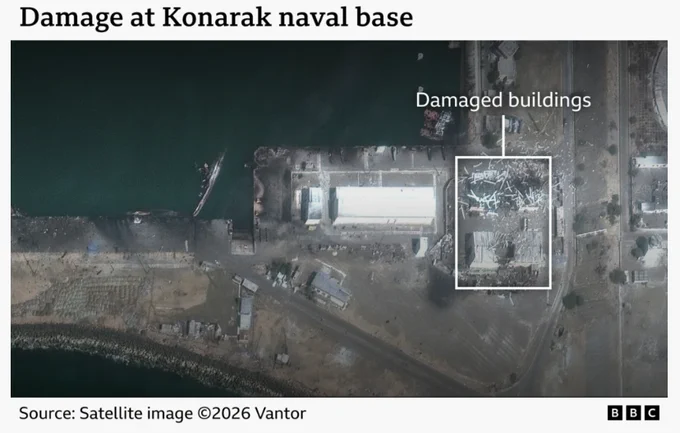
Here are some side by side comparisons of known strike locations with the PWTT damage detection in iran starting with Konarak naval base
bbc.co.uk/news/articles/cdxz…